Project Highlights
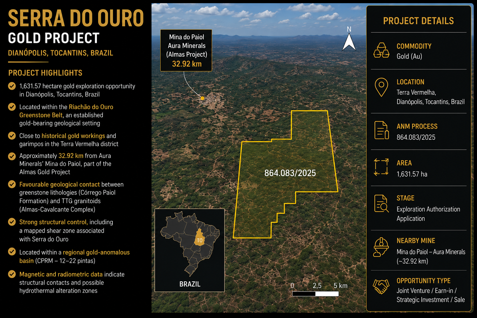
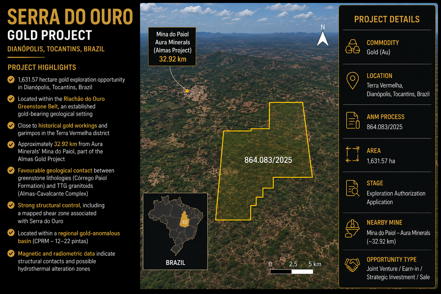
- 1,631.57 hectare gold exploration opportunity in Dianópolis, Tocantins, Brazil
- Located within the Riachão do Ouro Greenstone Belt, an established gold-bearing geological setting
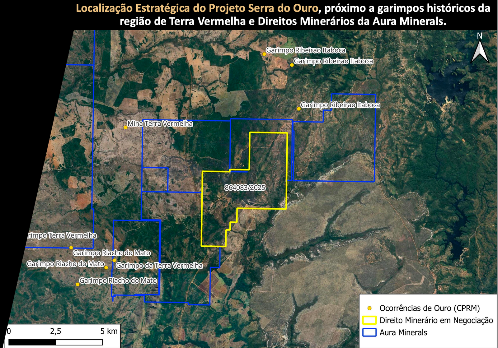
- Positioned close to historical gold workings in the Terra Vermelha district
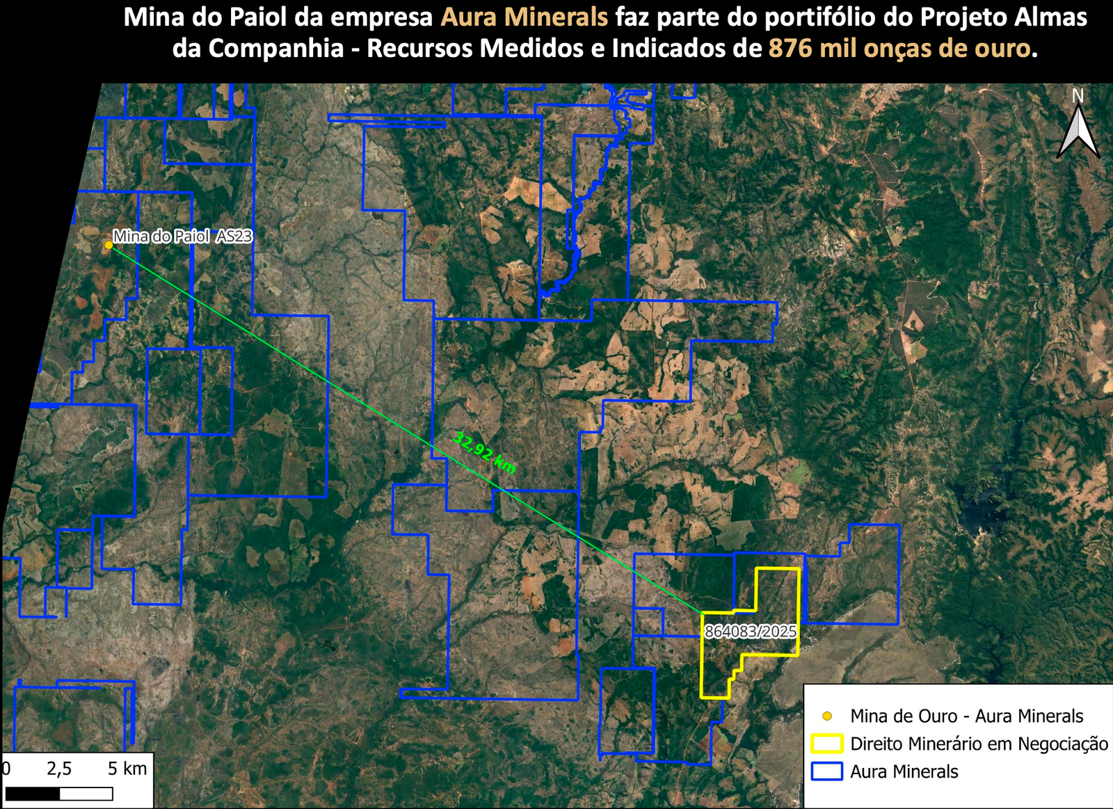
- Approximately 32.92 km from Aura Minerals’ Mina do Paiol, part of the Almas Gold Project
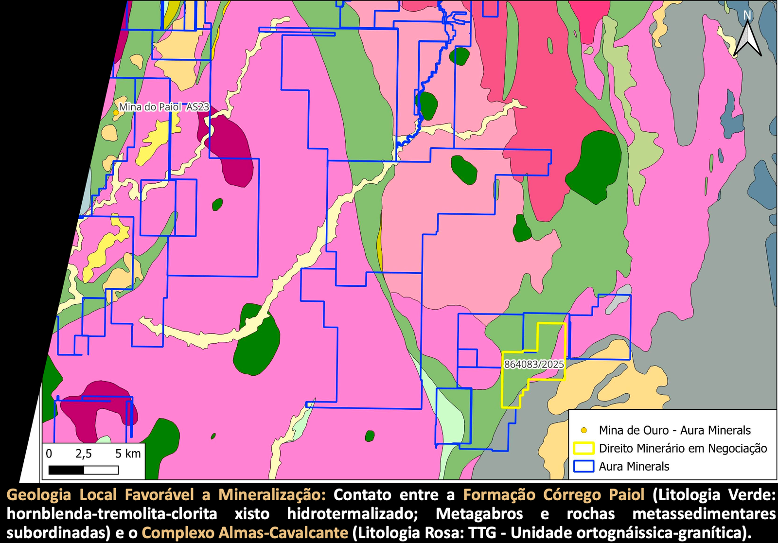
- Project area positioned along a favorable geological contact between greenstone lithologies and TTG granitoids
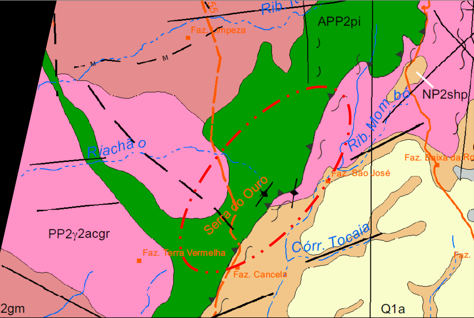
- Strong structural control, including a mapped shear zone associated with Serra do Ouro
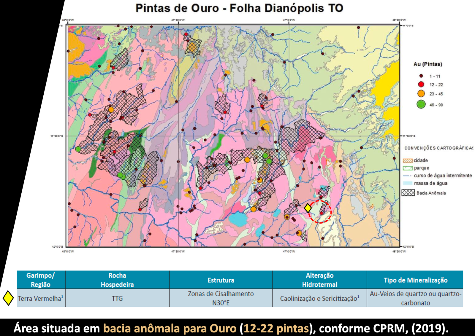
- Regional CPRM data places the project within an anomalous gold basin
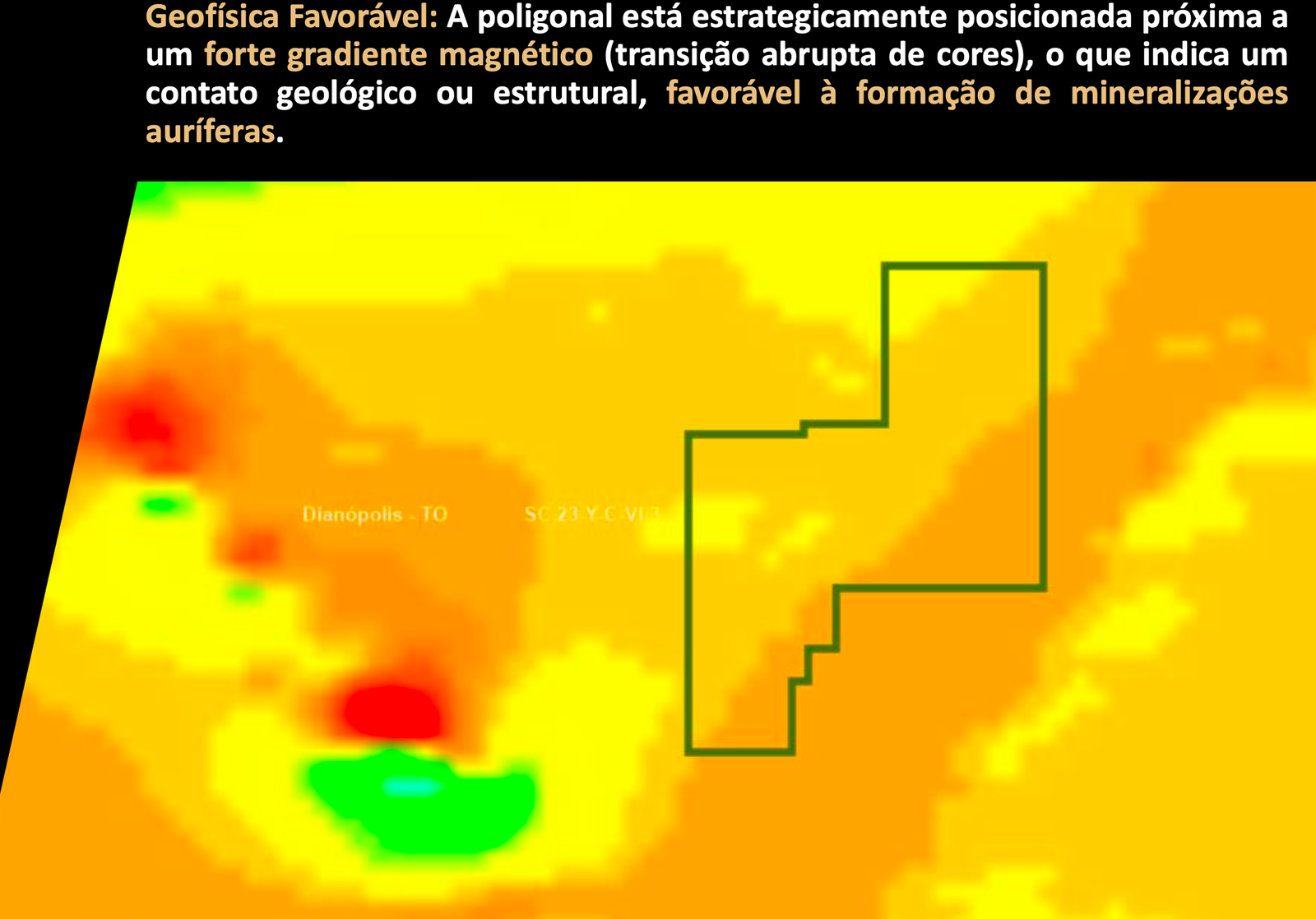
- Magnetic and radiometric datasets indicate structural contacts and possible hydrothermal alteration zones
Summary
The Serra do Ouro Gold Project comprises approximately 1,631.57 hectares in the Terra Vermelha region of Dianópolis, Tocantins State, Brazil.
The project lies within the Riachão do Ouro Greenstone Belt and is positioned in a district with multiple historical gold occurrences and artisanal workings. The property is located approximately 32.92 km from Aura Minerals’ Mina do Paiol, providing strong regional evidence of a productive gold-bearing system.
Regional geological mapping places the project close to the contact between the Córrego Paiol Formation, comprising hydrothermally altered hornblende–tremolite–chlorite schists, metagabbros and subordinate metasedimentary rocks, and the Almas-Cavalcante Complex, represented by TTG orthogneissic-granitic rocks.
The project is further supported by mapped shear structures, regional gold anomalies and magnetic and radiometric signatures interpreted as potentially associated with geological contacts and hydrothermal alteration.
Geological Overview
The Serra do Ouro Gold Project is located within the Riachão do Ouro Greenstone Belt, in a geological environment characterised by greenstone lithologies, TTG granitoids, major lithological contacts and regional deformation structures.
At the project scale, the principal geological feature is the contact between the Córrego Paiol Formation and the Almas-Cavalcante Complex. The source interpretation highlights hydrothermally altered schists, metagabbros and metasedimentary rocks along this contact, providing a favourable geological setting for structurally controlled gold mineralisation.
Structural mapping identifies a shear zone coincident with the Serra do Ouro area, while geophysical interpretation indicates a strong NE–SW structural control and significant magnetic gradients associated with geological or structural boundaries.
Regional CPRM data additionally places the area within a gold-anomalous basin reported in the source material as 12–22 “pintas”, while radiometric datasets show elevated potassium responses and other signatures interpreted in the project deck as potentially related to hydrothermal alteration.
Taken together, the geological setting, structural architecture, regional gold occurrences and geophysical signatures provide several independent exploration vectors for systematic follow-up work.
Image Gallery